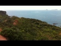
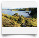
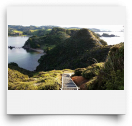
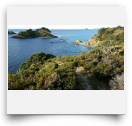
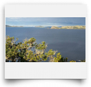
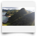
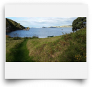
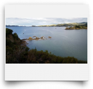
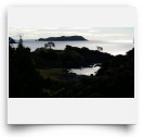
I didn't want this track to end...a 360° view at every turn...too bad it's only 35 minutes to the trig. My descriptive powers are spent - the Million-Dollar road ate up my verbiage...I've lost my adjectivity. Thus, I'll try to describe this track using ordinary DOC-speak:
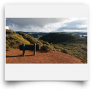
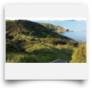
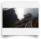
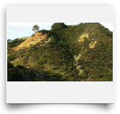
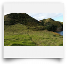
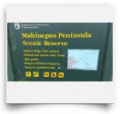
"2 hours return. Departing from the grassed carpark, this wide track negotiates private lands before ascending the first of numerous ridges. The peninsular track offers over-water views of both open forest and headland as it negotiates the regenerating manuka scrub. A short loop track towards the end ascends to the trig and provides opportunity to view nearby island groups. Care should be taken not to leave the track nor endanger yourself near water or waves. Approach sheer cliffs with care when attempting panoramic snaps. Under no circumstances venture past the trig to the dangerous red slope checkered with quizzical ignimbrite protrusions."
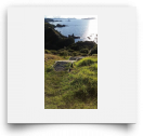
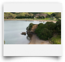
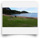
How'd I do?? Reckon I could write for DOC? Mahinepua cove is a little quiet beach with some baches and a sort-of caravan park. Not much going on except for walking, beachcombing, and maybe swimming with the odd dolphin or two. Nice. When you're out at the trig, make sure to use your binocs to try to find the Rainbow Warrior memorial on Matauri's hill. (Remember the lone Pohutukawa near the memorial?)


Comments
Wow! Stunning views every